Welcome to the final part in my five part series called “Going West 2012”. This five part blog has chronicled my 12 day trip to Kanab, UT, it’s surrounding adventures and back. Once every couple of years, hopefully more often as I do more of these blogs, I meticulously plan a trip somewhere with the intent of documenting and photographing the trip as well as the destination. So far in the blog I have been focusing on the major parts of the trip once I got out west from New York. This section however will attempt to tie up all of the loose ends and mini-adventures that I experienced along the way. It should probably be noted that the trip is literally planned to the minute in some sections so time spent at each location is minimal and with purpose.
Hometown, NY to Chesterton, Indiana (608 miles / 9 hours)
First leg of the trip is from my home town in Chemung County, New York to my first hotel stop in Chesterton, Indiana. Chesterton is just east of Chicago and marks the turning point south from Lake Michigan. Leaving New York at 6am, it is our plan to drive the 608 miles/9 hours straight on through to the hotel in Chesterton. I picked Chesterton because it was near Lake Michigan which I have always wanted to see and thought it might be cool to see if I could catch a nice sunset there. The first leg of the trip from NY to Erie, PA is slow going in very windy and rainy weather. My first stop for gas and a tire puncture repair kit is in a small town just outside Jamestown called Falconer, NY. In all my years of living in NY, I had never heard of Falconer. I needed a puncture kit as I suddenly remembered that my new Veloster did not have a spare. Wouldn’t want to be in the middle of the desert and get a flat with no way out. Anyway, It was pouring rain, but I managed to get this shot of the community building there.
It was a nice little town. Even stopped for a donuts and coffee at a Tim Horton’s on the way out. While there, I learned that it was not pronounced like the bird wrangler “Falcon-er” but rather more like “Fall-Coner”. Anyway, off to Indiana but not without a stop first. It rained buckets all the way to Cleveland then suddenly the skies parted. As we approached Cleveland on the Cleveland Memorial Shoreway we could see massive waves of Lake Erie crashing on the waterfront. After a few left turns we made our way to the shore for some photos.
Leaving Cleveland and it’s angry waters we made a mad scramble for Chesterton. Luckily, we arrived with just enough time to find our hotel, and realize that we had gained a whole hour back with the time change. This would give us time to grab some food and then hit the Indiana Dunes National Shoreline to catch the sun setting on Lake Michigan. We asked the hotel concierge for suggestions and they directed us to a small grill in downtown Chesterton called Octave.
Yes, my lunch was a cold refreshing Abita Strawberry Wheat beer. (as seen at Merlotte’s on the TV show True Blood) Later awarded best beer of the entire trip.
Okay, I did have a big plate of sweet potato fries and they were amazing too. We would definitely have to stop back for a full meal on the return trip! Highly recommended, look for my art hanging on the walls there if you stop! We make our way to the Michigan shoreline and Indiana Dunes to catch the sunset. While waiting for the sun to go down I notice a skyline on the horizon.
Yes, that is Chicago across the lake. And, to the left of that, what looks to be Burns Harbor and a strange cloud anomaly on the lake.
The sun finally began to sink so out comes the crystal ball.
Don’t worry, I didn’t leave my friend the gull out of the shoot.
The shadows are growing long and its getting time to make the long sandy hike back and drive to the hotel to get some much-needed rest for the 10 hour drive to Kearney, Nebraska in the morning.
After a good nights rest we are up early, grab a nice breakfast at Bob Evans and prepare to hit the fly over states. 678 miles of straight, boring, endless, cornfields.
Chesterton, Indiana to Kearney, Nebraska (678 miles / 10 hours)
I can sum up the entire 678 miles with two photos.
Well I would have to make this trip again on the way back, and please no hate mail from the mid-west, but I will never go that way again. In 2010 we traveled out west and went by way of Texas and the drive was much more enjoyable. We arrive in Kearney late but it was planned that way. The first two legs were mapped out to be longer so that the last two would be shorter, knowing that the scenery would dictate more exploration.
Kearney, Nebraska to Rifle, Colorado (538 miles / 8 hours)
The next leg is 573 miles to Rifle Colorado and would start bright and early on the morning of day 3 with a similar look as day 2.
The route would be flat and boring, at least at the beginning. Once we reached Colorado it was clear we were in for a treat. The aspens were all turning their famous bright golden color. This shot was taken at a rest stop just outside Sterling, CO near the Pawnee National Grasslands.
And the not so colorful yet still spectacular version from the opposite side of the road.
Fortunately the quick trip between Kearney and Rifle would give us time to take some exploratory liberties once we reached Colorado. One such freedom would be suggested by my partner to take the scenic route over the Colorado Rockies on County Route 1. Now here in New York, County Routes are usually nice paved roads. That would not be the case in good ole Colorado. Oh, it started out paved, for the first 100 yards. Then it went straight up the mountain, rally car style. Here is a short 2 minute stop motion video that I made from my hood mounted GoPro Hero 2 camera of the entire 23 miles.
In the video you can see the several points where we pulled over to take photos. Here are a few shots taken during our ascent. The skies were truly gorgeous this day.
Here is a panorama that I stopped to shoot of a distant range that you can clearly see was once an ancient volcano.
Before the road demanded too much concentration I decided to pull over one more time and grab this shot from whence we came.
180° stands this very cool formation.
Time to concentrate and drive. We cover about 20 miles of single lane dirt roads through the mountains and finally pull over to take in this gorgeous view.
Below us the, through the valley runs the California Zephyr passenger tour train. I slapped on the Sigma 70-200mm and took this shot of the train and gave it a bit of tilt-shift treatment to “miniaturize” the train a bit.
Turns out, this is the highest spot on the road and it is all downhill from here. Fortunately, this won’t be the case for the scenery.
Suddenly off the side of the road I see a “Land For Sale” sign. Sounds like a MUST photo-op. Here is a shot of me shooting the shot.
And here is my shot. A 9 frame panorama, handheld, consisting of 27 total exposures.
Finally we reach a small town and the Colorado river, time for another stop and photo-op. Felt like kind of a rock star here as a jeep full of young ladies stopped on the road near where I was shooting to give me a woohoo and a shout out. Even though my girlfriend was there and I had to pass it off, but it did make this old guy feel pretty good. 😉
We connect with route 131 and finally back to the main road interstate 70. A quick stop for gas and a small rest stop provides a nice little park hike and another beautiful photo-op. Colorado is very much a photogenic state.
Interesting story about shooting with the looking-glass here. During one shot that ended up getting scratched, the sun came out and nearly started a fire in the dry grass. The ball concentrates any light to a single focused point. You have to be very careful not to start a fire or burn yourself while carrying it. I generally keep the ball under wraps until I am ready to shoot. Here is a final panorama of the area I was shooting at.
With sunlight fading and just an hours drive left to our destination in Rifle, CO we decide to drive straight through. An early morning start is planned with a visit to Rifle Falls before heading on to our extended stay in Kanab, Utah about 6.4 hours away. Through the tunnel, and off to Rifle we go!
Rifle, Colorado to Kanab, Utah (434 miles / 6.4 hours)
Now on the final leg of our journey across the United States into Kanab, Utah which will be home base for the next 5 days we schedule in a morning run to Rifle Falls State Park. A small but very unique park just a few miles from our hotel. My sights are set on a triple waterfall located at the park, but the trip there reveals even more surprises. The first being this seemingly abandoned site, seems like no matter where I go this stuff finds me. 😉
This was just a drive-by shot. It definitely warrants further investigation on the way out. We make our way to Rifle Falls “State Park” which upon first view looks to be a glorified trailer park. After parking, outfitting, and a short hike, it reveals itself to be a pretty cool place. The first encounter is with Rifle falls itself. A beautiful triple waterfall that is a byproduct of a redirected stream from above. The results, a lush tropical oasis among the limestone cliffs, and caves. YES, caves! We’ll get to that in a bit.
While I am fixated on shooting the falls, my girlfriend spots a map that leads to some limestone caves further up the trail. We hike to investigate and sure enough, caves!
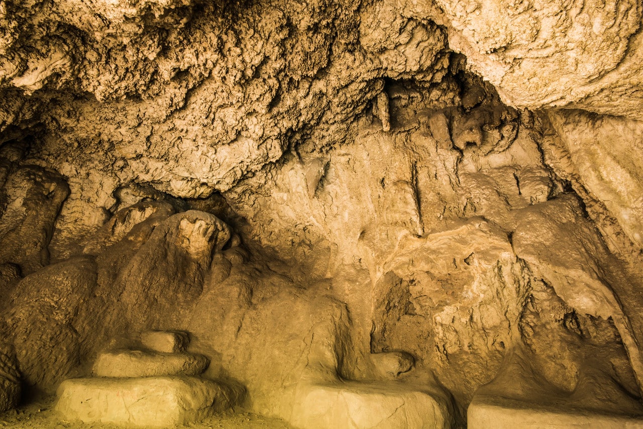
Limestone is well-known in the paranormal world as a serious conduit for supernatural activity. We saw no ghosts this day but it was still pretty magical. The roughed out trail features many different caves, nooks and crannies to investigate and film.
Since the magic was flowing pretty steadily I decided to break out the looking-glass and attempt some magic of my own.
Beyond the caves are a semi-hidden wildlife trail that follows along a shallow creek bed. We decide to investigate further. The overall sense I got here was completely Sherwood Forest-like.
All the while I am taking these shots, a pair of wary eyes are upon me. Finally the creature shows its face.
This little squirrel was having a ball climbing all over the cave walls and keeping a close eye on everything I was doing. One last stop at the falls on the way out to take this final shot.
Having spent the better part of our morning exploring this small yet very mysterious state park we decide it is time to make our way to Kanab with once exception, to check out the abandoned cabin we saw on the way in. Normally, I will do weeks of research on a site before filming or even exploring. This would be a “poke & hope” situation. I was just hoping there would be no gunfire. 🙂 This first shot looks to be an old homestead. I decided to shoot this from the road seeing no clear path to the property.
Up the road about 100 yards is a pull off and a driveway to another area that looks to be some sort of mining area. Several abandoned log cabins here and various machinery.
As I move in for a closer look I ring out several “Hellos” and “Anyone home?”. No responses, but as I take this next shot I hear a crash and disturbance from the distance reaches of the property.
I decide that it is best I head back to the car. It is not overly brilliant to explore a place such as this, alone. Once back to the car I snap this shot of the surrounding countryside and decide it is time to get out of Dodge er, Rifle.
With a wee bit of the ghost town heebee-jeebees in us we hightail it 143 miles to the west before we decide it must be safe to pull over now and take a much-needed rest. We find an expansive rest stop just off the highway in Grand, Utah. We get out to stretch our legs and of course the amazing view beckons. That and a massive storm moving into the region make for some exciting shots.
If you notice, you see very little of the actual rest stop in these shots. As with everywhere I go, I tend to move off the beaten path to get a different perspective on the area. I had to be careful here as this rest stop is right on the edge of a small canyon. A wrong step here on my part and this trip would come to a quick end.
With the rains moving in we decide it is time to move on. Soon the rain overtakes us and it is slow going for a while. Once we see a break in the wet we make another pit-stop. These shots are from small gas station halfway between the Utah/Colorado border and the small town of Green River.
It was apparent at this time, the rain was chasing us so no time to waste. It would be about 50 miles west that we would finally out-run the rain. Not quite ready to stop, I shoot these next two panorama shots from the moving car. For the speed we were traveling and the available light, I am very happy with the way they turned out. These are both from the beautiful Green River, Utah area.
As the refreshments take hold from the last stop, we make a rest stop just 15 miles outside Green River. The rock formations here are truly awe-inspiring. As if someone just reached down and peeled back a layer of the Earth’s crust.
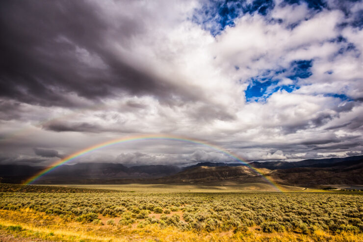
The rest of the day would be spent buckling down and completing the remaining 4 hour drive to Kanab. We arrive late in the day and set up what will be home base for the next 5 days as we explore the beautiful southwestern United States. One of the days as we drove through Page, Arizona we were blessed with this road side wonder.
At the end of this entry you will find links to the 5 days we spent in Kanab, Utah and the amazing places I photographed.
Kanab, Utah to Hometown, NY ~ The trip home (2243 miles / 33 hours)
No, the drive would not be straight through. In fact the drive would be exactly as it was on the way out. Same hotels and all. This was done for ease of planning, timing, and to account for the lost time-zone hours. Plus, the hotels we stayed at offered discounts for the double booking. Although the trip would be just as beautiful on the way back, there were only a few planned stops. The idea was just to enjoy the drive and spend less time worrying about sunlight, deadlines, etc. The next series of shots are just random leftovers from various stops that have not been covered yet. Enjoy them and we will pick up the story at our last adventure before heading home. If you click the photos to enlarge, descriptions of locations are listed with the photo.
And just like that we are back in Chesterton, Indiana and eating dinner at the amazing Octave Grill. The next day we rise early so that we may catch the sunrise at Indiana Dunes park. It does not disappoint! Here is a 25 second exposure using my B+W ND60 filter to smooth the water. I just love the lines of this shot. Quite a contrast from the first visit on the way out.
The beach was empty and the light was epic!
The sun was taking its sweet time rising, which is okay. After all, nothing left to do this day than to drive the last leg and end our journey. I was in no rush to do that. Time to break out the looking-glass for one last time this trip.
This log was so intriguing I decided to set up the GoPro and do a time-lapse of the sky, waves, and all the little creatures putting on a show.
While continuing to wait for the sun to pop it’s head up I did a series of wave abstract macros. These are very difficult to get the focus right and took a lot of practice. Out of the 100 shots I took, these are the only ones that made the grade.
I even had time to catch a seagull actually catching real prey! Something we just don’t see around our parts. This guy definitely was not a sky rat.
While that little freshwater lobster was not so lucky, this one was. The water washed him up on the sand and he managed to make his way back to the safety of the depths.
Just as he sank below the surface, the sun finally broke and cast gold everywhere.
This was it, the sun was rising. Unfortunately, not in a position that I could catch it on the lake. But, it was just good being there and reflecting back on the long journey. I wanted so badly to just remain there and not return. So much so that I even bothered to take a photo of the nuke plant down the coast.
Well, that’s it folks. Nothing left to do now but make the 10 hour drive back home. Always the saddest but most relieving part of any journey. Not glad that it is ending but glad we made it through with no troubles. So while I drive 9 hours, I will leave you with the 5 other segments of the trip. If you haven’t checked them out, I highly suggest you do. And please support my journeys and photos buy purchasing a print from the gallery and/or sharing these stories on your social networks. Thanks and see you on the road!
~A.D.
Going West 2012 ~ Part One : Hiking Red Canyon, Bryce, and more.
Going West 2012 ~ Part Two : Hotel, Schmotel!
Going West 2012 ~ Part Three : A Day, and Night in Zion
Going West 2012 ~ Part Four : Goblin Valley, Toad Stools, and Ghosts, Oh My!












Wonderful photos and story behind the photos! Excellent work as always!
This is totally awesome A.D., what a great wrap-up to a series I’ve enjoyed very much!